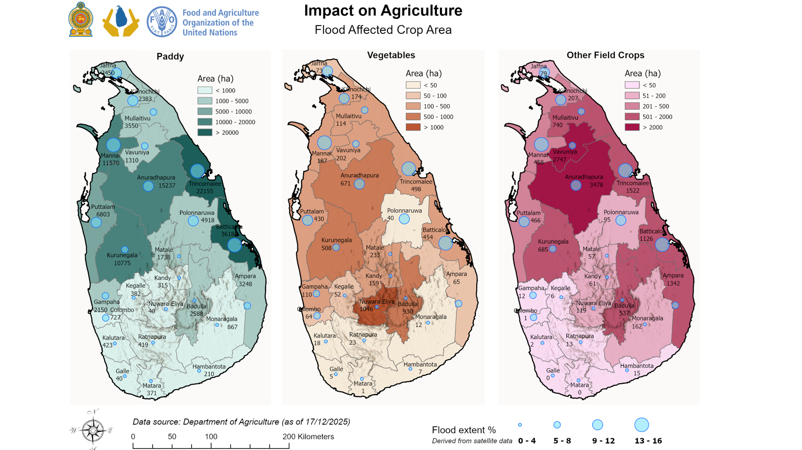
Approximately 58,340 hectares of paddy fields in Trincomalee and Batticaloa have been affected by floods caused by Cyclone Ditwah, according to data maps compiled by the UN Food and Agriculture Organisation (FAO) and Sri Lanka’s Department of Agriculture.
The maps indicate that the most severe damage has occurred in several key agricultural districts, impacting not only paddy but also vegetables and other field crops. The newly released data from the Department of Agriculture, compiled with support from the FAO, underscores the widespread effects of flooding on Sri Lanka’s agricultural sector.
“These impacts threaten livelihoods, food production, and household food security, particularly for smallholder farmers,” the FAO stated. The organisation is collaborating closely with national authorities and other partners to assess the damage, prioritise urgent needs, and support efforts toward timely recovery and rehabilitation.
The maps were created using data from the Department of Agriculture and flood extent information derived from satellite imagery.
(Colombo/Dec18/2025)